University of Florida Homepage

Mapping fire-impacted refugee camps using the integration of field data and remote sensing approaches

MEHEDY, SOUTHWORTH – Mapping fire-impacted refugee camps using the integration of field data and remote sensing approaches Mohammad Mehedy Hasan, Ikramul Hasan, Jane Southworth, Tatiana Loboda Article first published online: 21 November 2022 DOI: https://doi.org/10.1016/j.jag.2022.103120 ABSTRACT: The impacts of fires on society and the environment are wide-ranging, and examining such fire incidents is of critical […]
Meet the Geographer: Mohammad Mehedy Hassan

Mohammad Mehedy Hassan Pronouns: he/him University of Florida Adviser: Dr. Jane Southworth Focus Area: GeoSpatial Analysis & Techniques Earth System Science Research Statement: I am a geospatial scientist with an interest in the use of remote sensing (RS) and geospatial techniques analyses to better understand the complex socioecological process of landscape transformation, vegetation-climate change interactions, […]

Mapping Time-Space Brickfield Development Dynamics in Peri-Urban Area of Dhaka, Bangladesh

MEHEDY, SOUTHWORTH – Mapping Time-Space Brickfield Development Dynamics in Peri-Urban Area of Dhaka, Bangladesh Mohammad Mehedy Hassan, Levente Juhász, and Jane Southworth Article first published online: 11 OCT 2019 International Journal of Geo-Information DOI: 10.3390/ijgi8100447 ABSTRACT: Due to the high demand for cheap construction materials, clay-made brick manufacturing has become a thriving industry in Bangladesh, […]

Spatial pattern analysis of manufacturing industries in Keraniganj, Dhaka, Bangladesh

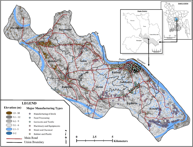
ALENEZI, GOOD,  MEHEDY – Spatial pattern analysis of manufacturing industries in Keraniganj, Dhaka, Bangladesh Mohammad Mehedy Hassan, Meshari S. Alenezi, Ryan Z. Good Article first published online: 01 JAN 2019 GeoJournal DOI: 10.1007/s10708-018-9961-5 ABSTRACT: Understanding industrial clustering and its patterns of development are important steps in linking regional policy development, strategic decision making, business site […]

Monitoring land use/land cover change, urban growth dynamics and landscape pattern analysis in five fastest urbanized cities in Bangladesh

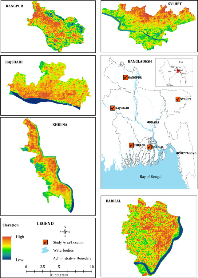
MEHEDY – Monitoring land use/land cover change, urban growth dynamics and landscape pattern analysis in five fastest urbanized cities in Bangladesh Mohammad Mehedy Hassan Article first published online: 08 JUL 2017 Remote Sensing Applications: Society and Environment DOI: 10.1016/j.rsase.2017.07.001 ABSTRACT: With little known and explored urban morphology in the fastest growing countries like Bangladesh in […]

Dr. Mohammad Mehedy Hassan

mehedy@ufl.edu Google Scholar Country of Origin: Bangladesh Degree Program: PhD Entered Program: Fall 2016 Expected Graduation: Spring 2020 Dissertation Topic: TBD Areas of interest: My research interests are in remote sensing and GIS applications in the field of Land use/ land cover change monitoring and evaluate its impact on the biophysical environment and terrestrial ecosystem. I am […]