When rivers impinge on the steep bluffs of valley walls, dynamic changes stem from a combination of fluvial and mass wasting processes.
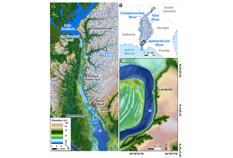
This study identifies the geomorphic changes, drivers, and timing of a landslide adjacent to the Apalachicola River at Alum Bluff, the tallest natural geological exposure in Florida at ~40 m, comprising horizontal sediments of mixed lithology.
We used hydrographic surveys from 1960 and 2010, two sets of LiDAR from 2007 and 2018, historical aerial, drone, and ground photography, and satellite imagery to interpret changes at this bluff and river bottom.
Evidence of slope failure includes a recessed upper section with concave scarps and debris fans in the lower section with subaqueous features including two occlusions and a small island exposed from the channel bottom at lower water levels.
Aerial photos and satellite images indicate that the failure occurred in at least two phases in early 2013 and 2015. The loss in volume in the 11-year interval, dominantly from the upper portion of the bluff, was ~72,750 cubic meters and was offset by gains of ~14,760 cubic meters at the lower portion of the bluff, suggesting that nearly 80% of the material traveled into the river, causing changes in riverbed morphology from the runout.
Despite being along a cutbank and next to the scour pool of a large meandering river, this failure was not driven by floods and the associated lateral erosion, but instead by rainfall in noncohesive sediments at the upper portion of the bluff. This medium-magnitude landslide is now the second documented landslide in Florida.
Mossa, J., & Chen, Y. H. (2025). Landslide at the River’s Edge: Alum Bluff, Apalachicola River, Florida. Geosciences, 15(4), 130.