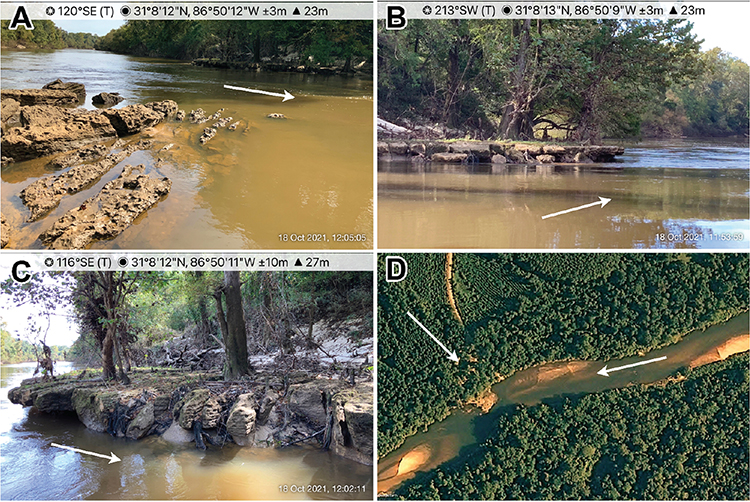
MOSSA – Shoal Destruction at Mancil Rock, Conecuh River, Alabama
Article first published online: 19 May 2023
DOI: https://muse.jhu.edu/article/896302
Lumber was an important component of the economy of the rural southeastern US in the late 1800s and early 1900s, and rivers provided less expensive routes than rail for floating either timber rafts or loose logs to major ports on the coast. However, obstacles and insufficient river depths throughout much of the year limited the use of rivers for this purpose. Army engineers documented conditions in these rivers and received appropriations from Congress to fund crews to clear out obstacles such as snags, rafts, wood jams, and overhanging trees in rivers across the United States (Wohl 2014). The annual reports of the Chief of Engineers describe the quantity of wood removed, but limited records exist for the rock, marl, clay shoals, islands, and boulders destroyed or modified to allow river transportation. One of many sites where Army engineers proposed work was the Escambia-Conecuh river system in Florida and Alabama (Chief of Engineers 1879). The Chief of Engineers (1879) described the Conecuh River as “impassable for boats, and even the transportation of timber and saw-logs during high-water is difficult.” Regrettably, the maps that accompanied this report could not be located.
Read the full publication in Southeastern Geographer.