HASSAN, SOUTHWORTH – The role of the refugee crises in driving forest cover change and fragmentation in Teknaf, Bangladesh
Mohammad Mehedy Hassan, Matthew Duveneck, Jane Southworth
Article first published online: 28 December 2022
DOI: https://doi.org/10.1016/j.ecoinf.2022.101966
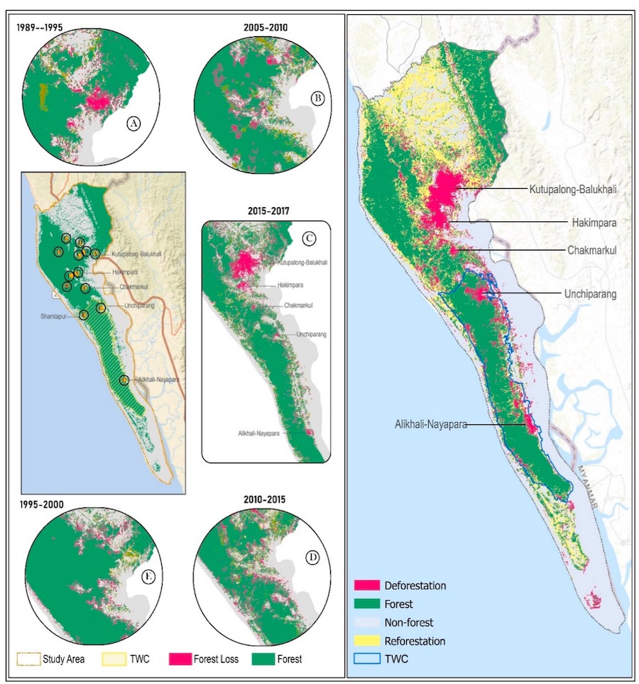
ABSTRACT: This research has employed remotely sensed data and image classification techniques for the first time to track three decades (1989 to 2021) of forest cover change and forest fragmentation across the largest Rohingya refugee settlement in the Teknaf peninsula, in Bangladesh. Forest fragmentation was evaluated in terms of forest core, patch, perforated, and edge, to characterize forest morphological changes at the landscape level. The results revealed that the forest occupying the study area was 97,400 acres in 1989, which decreased to 92,400 acres by 2015 (5% change) due to firewood collection. However, a sharp decline in the forest was observed in 2017, when the Rohingya refugees settled in the region causing an additional loss of 600 acres of protected forest and 7500 acres of non-protected forests. Such a drastic forest cover change led by refugee settlements has altered forest morphological patterns. As a result, in 1989, the core forest area was 42% which declined to 25% in 2015, and 20% in 2017. This loss of core area greatly increased the patch, perforated and edge areas. Through the efforts of restoration activities, the area of the core forest increased to 28% in 2019 and further increased to 32% in 2021. By 2019, the 5500 acres of non-protected forest was regained, and the protected forest increased by 770 acres. Forest recovery was sustained through the end of 2021, and the total forest in the study area was estimated to be 93,300 acres by this period. This study provides detailed information on the spatial and temporal evaluation of forest change and forest fragmentation metrics intending to understand the historic and ongoing forest disturbance regime, particularly in the ecologically critical zone of the Teknaf wildlife sanctuary. This analysis should encourage managers to enact varying forest restoration and rehabilitation strategies in the region.
Read the full publication at Ecological Informatics.