University of Florida Homepage

Modeling time-varying spatial accessibility to healthcare

Mao, L. (2025). Modeling time-varying spatial accessibility to healthcare: A system dynamic approach. Health & Place, 91, 103416. ABSTRACT: Spatial accessibility to healthcare is essential for policymakers to identify health disparities and develop targeted interventions. Current modeling approaches poorly capture temporal dynamics of contributing factors, and few have represented dynamic interactions among these factors. Further, […]

Identifying Points of Interest as sentinels for infectious disease surveillance

Du, F., & Mao, L. (2024). Identifying Points of Interest (POIs) as sentinels for infectious disease surveillance: a COVID-19 study. Spatial and Spatio-temporal Epidemiology, 100691, https://doi.org/10.1016/j.sste.2024.10069. ABSTRACT: Traditional surveillance relies on medical facilities, such as clinics and laboratories, as sentinels to monitor disease activities. Few studies have investigated the feasibility of using Point of Interests (POIs) […]

Daily rhythm of urban space usage: insights from the nexus of urban functions and human mobility

MAO – Daily rhythm of urban space usage: insights from the nexus of urban functions and human mobility Fangye Du, Jian Kang, Liang Mao, Jiaoe Wang Article first published online: 04 January 2024 DOI: https://doi.org/10.1057/s41599-023-02577-y ABSTRACT: As urban density increases, it becomes increasingly common for multiple functions to coexist within the same space, intensifying the […]

Enhancing the Retail Food Environment Index (RFEI) with Neighborhood Commuting Patterns: A Hybrid Human−Environment Measure

GLOVER, MAO, HU, ZHANG – Enhancing the Retail Food Environment Index (RFEI) with Neighborhood Commuting Patterns: A Hybrid Human−Environment Measure Bailey Glover, Liang Mao, Yujie Hu, Jiawen Zhang Article first published online: 30 August 2022 DOI: https://doi.org/10.3390/ijerph191710798 ABSTRACT: The Retail Food Environment Index (RFEI) and its variants have been widely used in public health to […]

Focus Area 7: Geospatial Analysis & Techniques

Modeling, Measurement, Visualization and Computation: techniques for the collection, analysis, interpretation and display of geospatial data, using tools such as GeoAI, GIS, Remote Sensing, GPS, and Spatial Statistics. Sub Areas GEOAI: Geographic Artificial Intelligence Geographic Information Systems (GIS) Remote Sensing Spatio-temporal analysis Geospatial Modeling Courses GIS2002: The Digital Earth GIS2114: Geographic Artificial Intelligence & Big […]

Focus Area 4: Geopolitics & The Global Economy

The turbulence of the current times has dramatically transformed the world’s economic and political geographies. The scale and scope of such changes require urgent attention. Important topics in this arena relate to: globalization and its impact on peoples and places; economic inequalities across geographic scales and borders; terrorism and power; the development of the knowledge-based economy; and […]

Focus Area 3: Places, Networks, & Flows

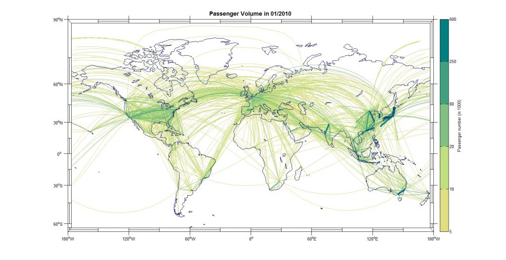
Geographers conceive of networks and flows between places as a foundational spatial concept. Geographic information systems (GIS) are the main analytical tools employed in determining relations between individuals, settlements, modes of transport, and infrastructures like power grids, and communication networks. The concepts can also be applied to disease contagion, healthcare service delivery, crime activities, river […]

Focus Area 2: Medical Geography in Global Health (MGGH)

Medical geography, an important area of health research, applies concepts, methods, and techniques from geography to investigate health-related topics across the world, focusing on spatial aspects of human and animal (livestock and wildlife) disease and health intervention. Sub-areas Disease modeling Risk mapping Spatial epidemiology analysis One Health Zoonotic emergence Spatial health disparities Network Analysis Health […]