It’s GIS Day!
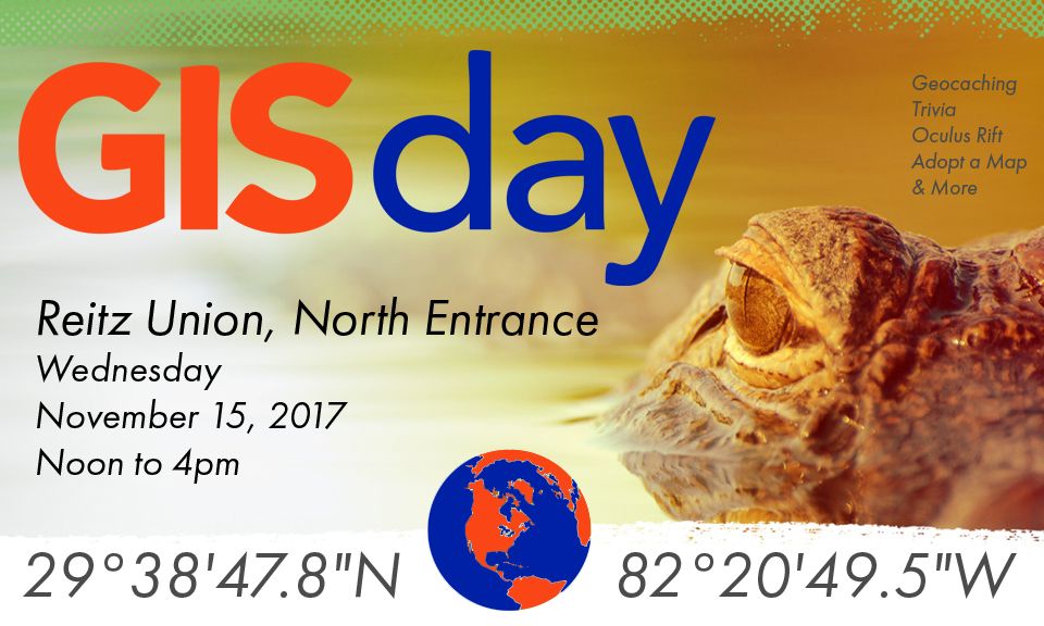
It’s GIS Day! Come join us at the North Entrance to Reitz Union between Noon and 4 PM!
It’s GIS Day! Come join us at the North Entrance to Reitz Union between Noon and 4 PM!

Associate Instructional Professor Affiliate faculty, School of Natural Resources and Environment and Center for Remote Sensing msounnyslitine@ufl.edu @sounny Focus Areas Focus Area 1: Earth System Science Focus Area 3: Places, Networks, & Flows Focus Area 6: Sustainability & Global Environmental Change Focus Area 7: Geospatial Analysis & Techniques Areas of Specialization GIScience Geomorphology Geomorphometry LiDAR Remote […]
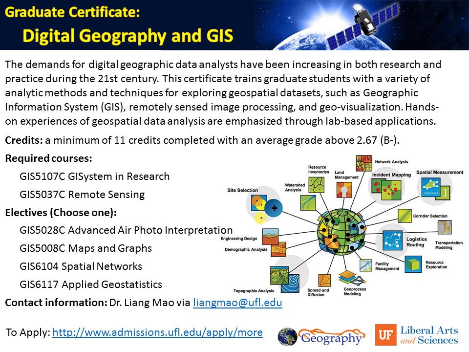
The demands for digital geographic data analysts have been increasing in both research and practice during the 21st century. This certificate trains graduate students with a variety of analytic methods and techniques for exploring geospatial datasets, such as Geographic Information System (GIS), remotely sensed image processing, and geo-visualization. Hands-on experiences of geospatial data analysis are […]
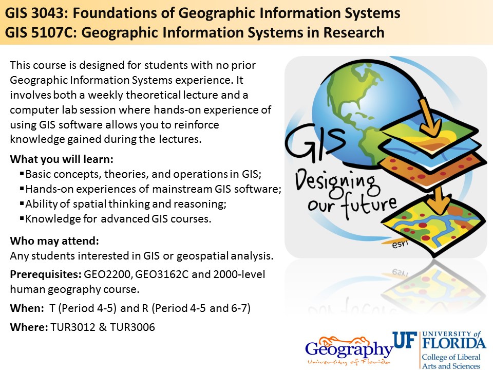
This course is designed for students with no prior Geographic Information Systems experience. It involves both a weekly theoretical lecture and a computer lab session where hands-on experience of using GIS software allows you to reinforce knowledge gained during the lectures. What you will learn: -Basic concepts, theories, and operations in GIS; -Hands-on experiences of […]

Affecting Factors and Per-Pixel Accuracy Prediction for Land Cover Classification Speaker: Dr. Reza Khatami Postdoctoral Fellow, Department of Geography, University of Florida Thursday, February 16, 2017 3:00-3:50 PM (Period 8) Turlington Hall Room 3012 University of Florida All are welcome to attend.
Forest Mosaics – Spatial Forest Management Patterns from Stands to Regional Scales in Southeastern U.S. Coastal Plain and Piedmont Speaker: Ms. Di Yang PhD Student, Department of Geography, University of Florida Thursday, February 9, 2017 3:00-3:50 PM (Period 8) Turlington Hall Room 3012 University of Florida All are welcome to attend.
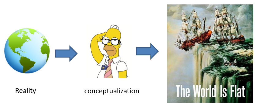
Geographic Conceptualization for GIS Representation and Analysis Speaker: Dr. May Yuan Ashbel Smith Professor of Geospatial Information Sciences in the School of Economic, Political, and Policy Sciences at the University of Texas at Dallas Thursday, November 17, 2016 3:00-3:50 PM (Period 8) Turlington Hall Room 3006 University of Florida All are welcome to attend.
Read more "Geography Colloquium: Geographic Conceptualization for GIS Representation and Analysis"
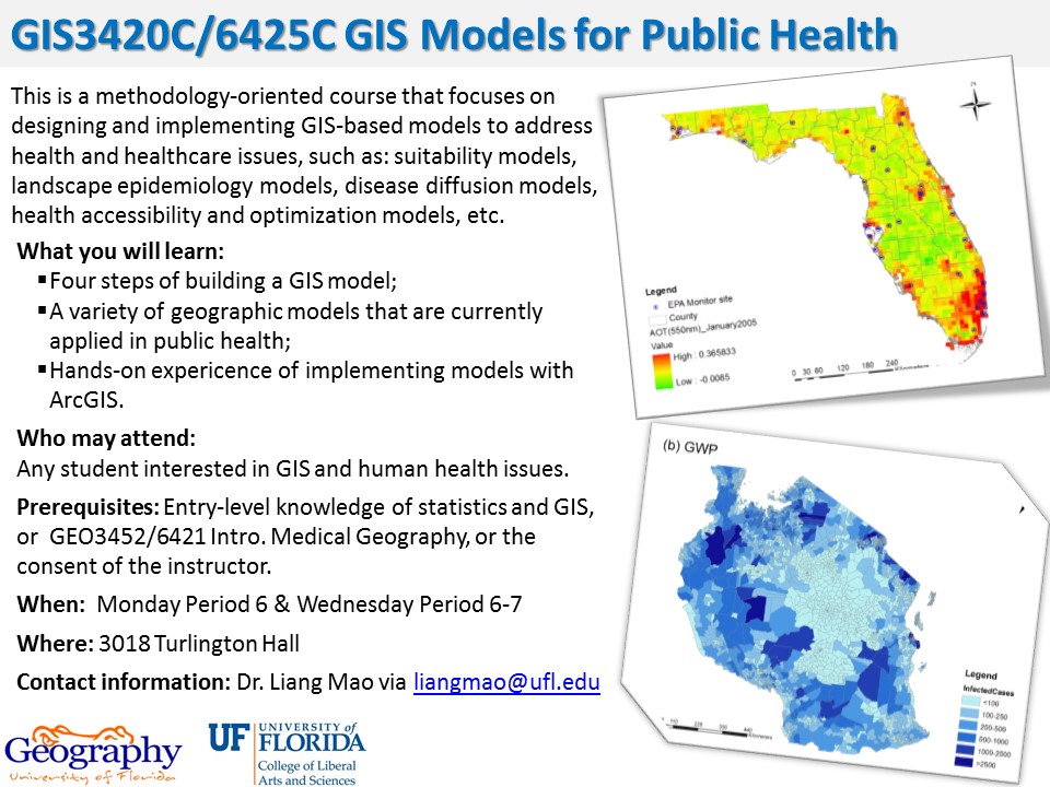
What you will learn: Four steps of building a GIS model A variety of geographic models that are currently applied in public health Hands-on experience of implementing models with ArcGIS
Read more "Spring Course: GIS3420C/GIS6425 GIS Models for Public Health"

What you will learn: Basic concepts, theories, and operations in GIS Hands-on experiences of mainstream GIS software Ability of spatial thinking and reasoning Knowledge for advanced GIS courses
tvjoyxq@ufl.edu Country of Origin: China Degree Program: M.S. Entered Program: Fall 2016 Expected Graduation: Spring 2018 Dissertation Topic: TBD Areas of interest: Medical Geography, GIS Adviser: Dr. Liang Mao Educational Background B.S. in GIS, Hunan Normal University