
A deep-Learning workflow for CORONA-based historical land use classifications
 Historical satellite imagery lacks efficient methods for automated land use mapping, particularly when working with CORONA satellite data from the Cold War era.
These high-resolution images from the 1960s offer valuable insights into historic land use conditions, but require intensive preprocessing and lack standardized methods for analysis.
This article presents an integrated and systematic workflow for preprocessing CORONA imagery and demonstrates an automated approach for land use classification that combines imagery and terrain feature analysis.
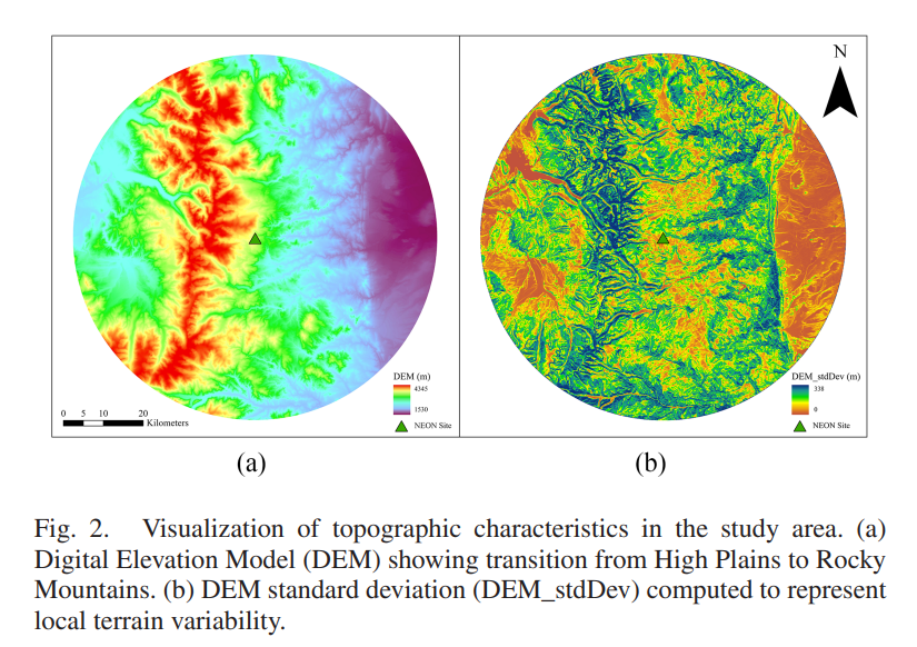
The preprocessing and classification framework was tested in a 35-km radius area near Boulder, Colorado at the National Ecological Observatory Network Niwot Ridge Mountain Research Station.
Results show that georeferencing achieved satisfactory accuracy with a mean absolute error of 5.99 m. The classification approach that uniquely incorporated terrain variation analysis achieved 89.36% overall accuracy (OA) in categorizing different land use types.
This combined classification approach significantly outperformed methods that used either CORONA imagery alone (OA 77.67% ) or basic terrain data alone (OA 79.72% ).
The combined system showed particular strength in distinguishing between different vegetation types such as forests and grasslands that appear similar in satellite images but have distinct terrain characteristics.
The successful integration of terrain feature analysis with panchromatic imagery overcomes traditional spectral limitations of historical satellite data.
This framework provides researchers with a robust and replicable method to optimize CORONA imagery for studying landscape transformations over the past 60 years.
Liu, W., Li, S., Fan, D., Wen, Y., Madson, A., Mitchell, J., He, Y., & Yang, D. (2025). A Deep Learning Workflow for CORONA-based Historical Land Use Classifications. IEEE Journal of Selected Topics in Applied Earth Observations and Remote Sensing 18, 16066-16080.