Wang, J., Hu, Y., Duan, L., & Michailidis, G. (2024). Analysing and visualising mobility vulnerability and recovery across Florida neighbourhoods: a case study of Hurricane Ian. Regional Studies, Regional Science, 11(1), 384-386. DOI: https://doi.org/10.1080/21681376.2024.2369550
Article first published online: 12 June 2024 in Regional Studies, Regional Science
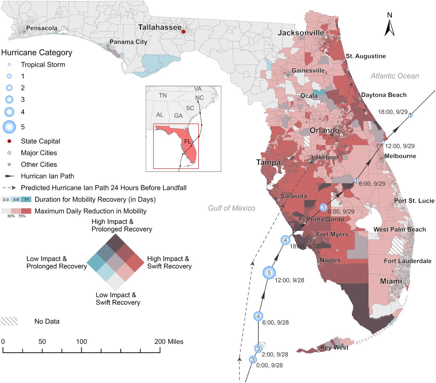
ABSTRACT: Effective hurricane preparedness and response demand a thorough understanding of the impact on mobility patterns. While existing studies have explored mobility disruptions caused by hurricanes, very few have delved into the impact, considering both mobility vulnerability and recovery, on a state level. Utilising mobile phone location data, this research examines the mobility patterns of Florida residents throughout Hurricane Ian. The findings reveal that the hurricane profoundly disturbed the mobility patterns of Floridians. The state experienced a maximum average daily mobility reduction of 63.41%, with certain neighbourhoods coming to a complete standstill at 100% cessation in mobility. On average, Florida neighbourhoods needed 2.61 days for mobility recovery, though this period stretched to as long as 92 days in the most severely affected areas. The bivariate map highlights a prevailing trend: neighbourhoods with prolonged recovery periods also witnessed more substantial reductions in mobility. This dual disadvantage underscores the critical need for increased focus on these neighbourhoods. Furthermore, our findings highlight the significance of factoring in forecasted hurricane paths when analysing mobility impacts, as we noted more substantial effects on neighbourhoods along the predicted trajectory.