WALTHER – Identifying local conflict trends in North and West Africa
Radil, Steven and Walther, Olivier
Article first published online: 9 March 2024
DOI: https://doi.org/10.1787/24142026
ABSTRACT:
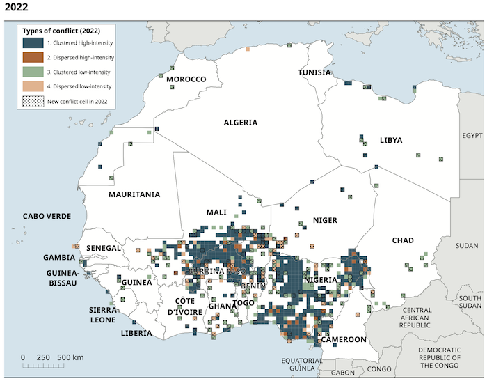
Several states in West Africa have experienced significant episodes of political violence since the early 2010s. These have included civil wars, religiously motivated terrorism, separatist insurgencies, military coups and communal strife, each of which have local, national and transnational dimensions. Intended to help guide responses to the region’s political challenges, the Sahel and West Africa Club (SWAC/OECD) created an interactive, spatial tool for policy makers in 2019, the Spatial Conflict Dynamics indicator (SCDi). The SCDi monitors political violence at subnational scales. It combines different quantitative dimensions of conflict into a mappable tool that describes the circumstances in each location. The latest enhancement to the SCDi brings two new features to aid the identification of local conflict trends. First, the tool now identifies regions that are newly entering into or exiting from conflict. This allows a more detailed picture of how the geography of conflict is spreading or contracting within and across national borders. Second, the tool now characterises the current conditions in a location as either worsening or improving, based on past conditions at the same location. The SCDi is implemented in SWAC’s new Mapping Territorial Transformations in Africa (MAPTA) platform.
Read the full publication in West African Papers.