KEELLINGS – Delineating and characterizing changes in heat wave events across the United States climate regions
Dan Wanyama, Erin L. Bunting, Nicholas Weil, & David Keellings
Article first published online: 20 January 2023
DOI: https://doi.org/10.1007/s10584-022-03476-y
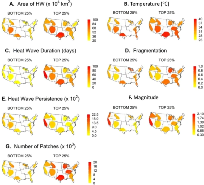
ABSTRACT: Exposure to extreme heat, or heat waves, represents a public health threat as well as an environmental health threat. With projections for further increases in temperature in some regions, resulting from global environmental change, it is important to understand the spatiotemporal impacts of heat waves in order to minimize risk. To understand heat wave impacts, one cannot look solely at the spatial and temporal temperature regimes but much also consider key heat wave characteristics: duration, size, magnitude, frequency, and region of impact. To understand the consequences of heat wave events, it is critical to analyze such extreme events based on the cumulative impacts of these characteristics. This study, which is conducted across the whole of the continental United States, looks to map and analyze such cumulative impacts of heat wave characteristics. Heat waves were spatially defined for the period of May–September of each year. Using persistence analyses and the development of a new index (combined heat wave characteristics index (CHCI)), we can define regions of consistent heat wave exposure and impact. Results show that there are large differences across the United States in terms of heat wave exposure and impacting heat wave characteristics. Across much of the analysis, a clear east versus west difference in patterns is seen. Overall, such work shows how and where differing but covarying heat wave characteristics impact the United States. Information from this work can be combined with demographic and health metrics to better pinpoint susceptibility to heat waves—and therefore inform better management decisions.
Read the full publication in Climatic Change.