MOSSA, CHEN – Geomorphic response to historic and ongoing human impacts in a large lowland river
Dr. Joann Mossa, Dr. Yin-Hsuen Chen
Article first published online: 1 Feb 2022
DOI: 10.1002/esp.5334
ABSTRACT: Lowland coastal plain rivers are important for navigation and ecosystems, having unique concerns regarding water and sediment management. The Apalachicola River in Florida, the lower end of the ACF (Apalachicola-Chattahoochee-Flint) system, had historical modifications beginning in the 1800s. Most impacts are attributable to a navigation project in the latter half of the twentieth century that included dredging, disposal, rock and snag removal, artificial cutoffs, and wing-dike building.
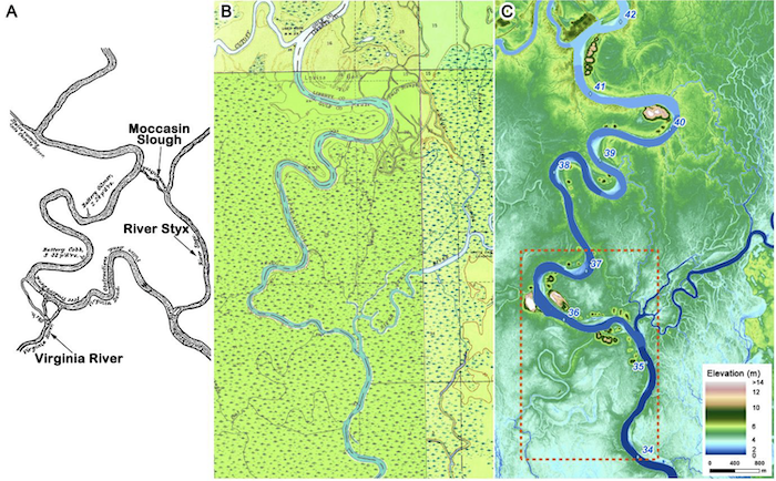
As one of few studies using paired hydrographic surveys over a long reach and time (170 km, 50 years), we defined four zones of bed elevation change between 1960 and 2010 based on the cumulative thalweg elevation plots. The river has four bed change zones: 1) uppermost, marked degradation from River mile (RM) 106 to 85 because of dam construction; 2) middle, minimal degradation from RM 85 to 34; 3) artificial cutoff zone, highest degradation, from RM 34 to 27; and, 4) lowermost zone, aggradation from RM 27 to Apalachicola Bay because of upstream bed and bank sediment disturbances. Artificial cutoffs and lithology influence lateral migration, with rates being highest in cut off zones and least in areas with some bedrock upstream and finer sediments downstream. Length changes from 1941 to 2019 are stable, except for the middle reach, which lengthened nearly 10%, and the lower non-tidal reach where length shortened with cutoffs then regained in subsequent decades. Minimizing disturbance has led to 18% of the sand bar area revegetating since a decade of dredging ended. This framework helps in understanding historic and ongoing human activities, notably upstream water consumption, connectivity changes, sediment inputs, and climate change, that will affect the water and sediment management of the river, its floodplain, and bay, thus varying approaches for restoration.
Read the full publication at Earth Surface Processes and Landforms.