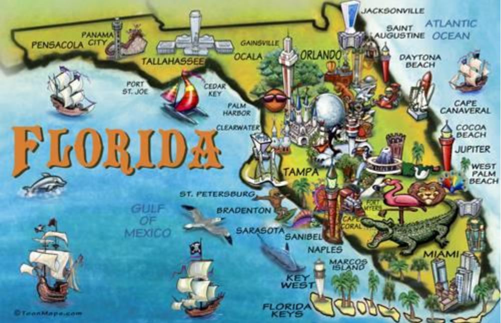
There will be a strong GeoGator presence at the 57th Annual Meeting of the Florida Society of Geographers this Saturday the 20th of February. Whether you want to learn about risk perceptions, coastal flooding, land use change, rural violence, riparian erosion and siltation, extreme rainfall, disease transmission, or park conservation, we’ve got you covered!
Physical Geography (Moderator – Joann Mossa, University of Florida)
9:00 – Holli Capps et al. – Interdecadal changes in extreme rainfalls in Ghana
Holli Capps (University of Florida), Peter Waylen (University of Florida), and Kwadwo Owusu (University of Ghana)
Interdecadal changes in extreme rainfalls in Ghana
There is considerable focus on the potential for increased frequency of extreme hydroclimatological events in the presence of climate change. In Ghana, with its reliance on rain-fed agriculture, the question of crop loss from flooding and soil erosion is further aggravated by concern whether the climate has recovered to conditions that prevailed prior to the regional drought of the 1970s and 80s. This study examines long-term (44-52 years), complete, daily rainfall records from 19 stations throughout Ghana to determine magnitude and frequency of daily rainfall totals exceeding levels equivalent to the historic 90th percentile of non-zero observations at each station. The results are sub-divided into three sub-populations corresponding to pre-drought, drought, and recovery periods and two basic research questions addressed; 1) Are there significant differences in any/all variables between periods at a station?, 2) Are there distinctive regional patterns in changes? The hypergeometric distribution is used to determine the statistical significance of the frequency with which observations exceed the long run median value of the variables and differences in the means during each period are mapped revealing heterogeneous effects of the drought and degrees of recovery. Locations along the coast have recovered in neither frequency nor magnitude, while mid-Ghana shows a fuller recovery. Outliers correspond to Axim in extreme southwestern Ghana and Navrongo in the north. KeteKrachi, located on Lake Volta, produces frequent anomalies, which may result from its local climatological setting.
Keywords: rainfall, extreme, Ghana, interdecadal variability
9:20 – Joann Mossa et al. – A large landslide along the Apalachicola River at Alum Bluff, Florida
Joann Mossa (University of Florida) and Yin-Hsuen Chen (University of Florida)
A large landslide along the Apalachicola River at Alum Bluff, Florida
Reported instances and scientific studies of landslides in the Gulf Coastal Plain region are rare. We examine a large landslide which occurred at Alum Bluff near River Mile 84.2 on the Apalachicola River in the central panhandle of Florida in 2013. At 40 m above the highest flood levels, Alum Bluff is the largest geological exposure in Florida and is comprised of varied Tertiary and Quaternary sediments. Field evidence of the slope failure includes a recessed upper section and debris fan in the lower section with some subaqueous changes including a small island protruding from the channel bottom at low and moderate water levels. We used two sets of LiDAR from 2007 and 2018, historical aerial photography and ground photography to interpret changes at this bluff. The area above the water line showed losses in elevation at the upper portion of the bluff and gains at the lower portion. The loss in volume, dominantly at the upper portion of the bluff, was ~72750 m3 and was offset by gains of ~14760 m3 at the lower portion of the bluff, suggesting that nearly 80% of the material from the failure is below water during median flows. Bluff erosion and failure provides sediment, a common pollutant, to rivers and have potential to alter riverbed morphology.
Keywords: landslide, sediment, LiDAR, geomorphic change, river bluffs
9:40 – Amobichukwu Amanambu et al. – Evaluating the impact of dam construction on the connectivity of a large coastal plain river
Amobichukwu Amanambu (University of Florida), Joann Mossa (University of Florida), and Yin-Hsuen Chen (University of Florida)
Evaluating the impact of dam construction on the connectivity of a large coastal plain river Globally, human influences on rivers and their ecosystems have become a subject of rising interest because of the impacts from increasing river fragmentation or disconnectivity. Dams cause flow and riverbed alterations with river ecosystem damage due to flow regulation, sediment trapping, and river disconnectivity. This research focuses on the Apalachicola River, a large coastal plain river with a wide floodplain comprised of many sloughs and tributaries. Jim Woodruff Lock and Dam is one of the primary causes of increasing longitudinal disconnectivity and floodplain drying. Stage levels have been declining since the mid-1950s due to both degradation and increasing water use upstream. The study used river connectivity and basin connectivity indices to evaluate the dam’s aggregate impact on river connectivity between 1960 and 2010. The effects of the dam on channel morphology are evident to ~35 km downstream. With increasing alteration caused by the dam, the result reveals substantial river disconnectivity in some parts of the tributaries of the Apalachicola River, highlighting variation in the spatial pattern of disconnectivity. The result of this study shows that understanding river connectivity is crucial for river functioning and sustainable management policies.
Keywords: disconnectivity, connectivity, rivers, dams
Human Geography (Moderator – Tobin Hindle, Florida Atlantic University)
10:40 – Matthew McKay – Connecticut River Valley: decline in cigar tobacco production in an era of globalization
Matthew McKay (University of Florida)
Connecticut River Valley: decline in cigar tobacco production in an era of globalization
The specific suburban/exurban municipalities of the prime agricultural lands of the Connecticut River Valley, at one time, entailed large-scale tobacco crop production as a substantial agricultural activity. “Tobacco Valley” encompassed open-field and “shade” tobacco farming that was dominant throughout much of the 20th Century, given that this type of tobacco had prominence on the rural landscape. The uniqueness of tobacco production in this area of New England was due to the soil conditions, topography, and microclimatic summer seasonal conditions that provided an ideal growing environment for the major inputs utilized to manufacture high quality cigars. The tobacco inputs from the Connecticut River Valley provided wrappers and binders for finished cigars. Consequently, the inputs toward cigar manufacturing were transported elsewhere for final assembly in the cigar production network (given that filler components would be produced in other tobacco-growing regions). However, property owners of tobacco (and other) farms witnessed falling revenues and profits during the mid-to-latter part of the 20th Century, thereby necessitating a transition of land toward becoming increasingly suburbanized. Yet, “Tobacco Valley” in New England has had an important role on the region’s economic geography, and certainly tobacco production has contributed to and been influenced by globalization, in addition to changing consumption patterns. With the decline of tobacco production after the 1960’s at this particular spatial scale, despite the continued niche market being fulfilled at yet a smaller scale, warrants further investigation so as to better understand the changing land use patterns that have ensued and to what extent tobacco production will continue in this prime agricultural valley of Southern New England.
Keywords: economic globalization, southern New England, cash crop, cigar tobacco
11:00 – Shreejana Bhattarai – Spatial and temporal pattern of indigenous and imported malaria in Nepal
Shreejana Bhattarai (University of Florida)
Spatial and temporal pattern of indigenous and imported malaria in Nepal
Malaria burden is decreasing in Nepal as it is preparing to eliminate malaria by 2026. However, several studies have shown that some malaria indicators are increasing in certain parts of the country and malaria have shifted to previously non-endemic areas. Thus, the objective of this study is to analyze the spatial variation in temporal trends of malaria in Nepal from 2005 to 2018, following the introduction of LLINs as vector control intervention. Spatial variation in temporal trend method was employed in SaTScan software to detect the unusually high or low temporal trends of malaria indicators. The three malaria indicators are Total Malaria, Indigenous Malaria, and Imported Malaria. All three malaria indicators have some clusters that have increasing trend. Indigenous Malaria is increasing by 113.71% in a cluster of three mountainous districts previously non-endemic to malaria. Imported Malaria has an increasing trend of 156.22% in a cluster in Kathmandu, the capital of the country. Even though, some clusters have a decreasing trend of malaria indicators, the trend is lower than that of outside the clusters. The total malaria burden is decreasing in Nepal as the country progresses closer to the elimination deadline. However, several clusters have an increasing trend of malaria indicators inside the cluster. Even though some clusters have a decreasing trend inside the cluster, the rate is much lower than outside the cluster. This information can help public health officials to make decisions for implementing vector control interventions to successfully eliminate malaria form the country.
Keywords: malaria elimination, Nepal, spatial variation, temporal trend, control intervention
11:20 – Audrey C. Smith et al. – Conflict in Africa: is the recent phenomena of land grabbing a threat multiplier?
Audrey C. Smith (University of Florida). Carly Muir (University of Florida), and Jane Southworth(University of Florida)
Conflict in Africa: is the recent phenomena of land grabbing a threat multiplier?
Conflict is one of Africa’s greatest challenges, and in addition to conflict deaths there also millions of internally displaced persons across the continent. The importance of understanding the possible drivers of conflict in Africa is thus an area of key importance for research, and one possible cause driving social conflict in the region is that of large-scale land acquisitions (LSLAs). LSLAs- commonly termed “land grabs”- have increased globally since 2000 with sub-Saharan Africa (SSA) a major target, yet their influence on conflict has not been well studied. As more than 60% of the population is smallholder farmers and an estimated 50 million are agro-pastoralists/pastoralists in SSA who depend directly on access to land and water resources for their livelihoods, we hypothesize that LSLAs- which represent a change in land tenure and access to resources- act as a ‘threat multiplier’ driving social conflict in the region. Here we perform a multi-country assessment of the links between large-scale land acquisitions and conflict in SSA by combining a georeferenced database of more than 10,000 individual land deals and data on annual conflict type and location between 2000 and 2019. We ask the following questions: 1) Is there a spatio-temporal relationship between conflict hotspots and proximity to and occurrence of LSLAs? 2) How does the relationship between conflict and LSLAs vary by country? Our preliminary results indicate that conflict hotspots spatially cluster with LSLAs, and countries with a greater proportion of total land area that are LSLAs have a higher occurrence of conflict events.
Keywords: conflict, resource scarcity, large-scale land acquisitions, hotspot analysis, Africa
11:40 – Matthew Pflaum – Pastoralist violence in North and West Africa
Matthew Pflaum (University of Florida)
Pastoralist violence in North and West Africa
This paper presents research that leverages ACLED data to examine temporal and spatial patterns of pastoralist violence to answer questions related to where pastoralist violence occurs, who the major actors are, and how it has shifted over time. The research first identifies pastoralist actors among the >4,000 groups involved in violent events in this region in the period, finding 188 distinct pastoralist actors. The research focuses on spatial and temporal dimensions of pastoralist violence and seeks to scientifically and rigorously address the assumptions about pastoralist violence, while also expanding analysis of pastoralist violence across 21 countries and all groups engaged in violence during this period. It finds that all countries except three have pastoralist groups engaged in violent events, the greatest burdens are in Mali and Nigeria, and temporally violence has increased since 2016. The number of pastoralist actors is also increasing, following the trend of expanding violence in the region since 2012. There are a diverse set of pastoralist actors engaged in violence across the region (armed militias, rebel groups, civilian/ethnic groups, extremist groups, self-defense groups), but five or so groups are responsible for a significant amount of the violence. Ethnic groups like Fulani are implicated in violence in many of the region’s countries, but should not be considered a unified group, with distinct ethnic and communal militias in each country and locality.
Keywords: Sahel, pastoralism, violence, spatial
Biogeography and Ethnobotany (Moderator – Maria Fadiman, Florida Atlantic University)
10:40 – Leandra Merz – Complexities of human wildlife coexistence in North Luangwa National Park
Leandra Merz (University of Florida)
Complexities of human wildlife coexistence in North Luangwa National Park
This paper examines the complexities of human-wildlife coexistence in protected areas borderlands. These borderlands are often vital for both human and wildlife populations, but human-wildlife interactions can result in conflict. Human-wildlife conflict is an interaction that has a negative impact on one or both parties, for example, crop raiding, livestock predation, poaching, habitat destruction, and disease transmission. Tolerance, or the willingness to accept additional costs of living with wildlife, is necessary for human-wildlife coexistence. By understanding tolerance levels and how they are formed, conservationists can design interventions targeted at improving coexistence. For this study, the author conducted 68 semi-structured interviews in a Game Management Area (GMA) outside North Luangwa National Park in Zambia. Interviews included free-listing, pile sorting, and ranking of common wildlife species. Participants experienced many direct costs from living with wildlife, but a complex and nuanced understanding also incorporated the current and potential benefits of wildlife through the local community based natural resource management (CBNRM) project. Ultimately, tolerance for conflict species was low, despite many positive attitudes toward these species. This study highlights the complex factors involved in determining tolerance of wildlife and the ability of humans to coexist with wildlife.
Keywords: human-wildlife conflict, tolerance, attitudes, elephants, Zambia
Poster Session
Samantha Timmers et al. – A data-driven analysis of compound flood occurrence along coastal rivers in Florida
Samantha Timmers (University of Florida) and Katherine Serafin (University of Florida)
A data-driven analysis of compound flood occurrence along coastal rivers in Florida
Flood events driven by multiple processes, such as high coastal water levels and high discharge events are known as compound flooding, and being able to identify and define the causes of compound flood events has become more significant as the climate changes. Coastal river systems may commonly experience compound flooding, yet few studies have evaluated the along-river conditions that make compound flooding likely. Mitigating future flood risk in populated areas surrounding rivers depends on understanding the processes driving such flood events and identifying their potential patterns in flood occurrence. The goal of this study is to analyze observational data from rivers within Florida and the southeastern United States in order to identify where along-river compound flood events may occur and to determine potential patterns within the region. To do this, we identify along-river flood events using the National Weather Service’s flooding thresholds and use daily observations of gage height and discharge data from United States Geological Survey stream gage stations to identify whether along-river flood events are caused by coastal and/or fluvial processes. Flood events across different rivers are then compared to identify patterns of when and where significant compound flooding is most likely to occur. This ongoing project will contribute to future efforts combining statistical and numerical modeling to analyze along-river compound flooding more accurately with the aim of ultimately assisting communities in mitigating their risk to compound flood events.
Keywords: compound flooding, river flood analysis
Christopher Williams et al. – People, perceptions, and plights: tornado sheltering during the COVID-19 pandemic
Christopher Williams (University Corporation for Atmospheric Research, University of Florida), Kevin Ash (University of Florida), Julie Demuth (National Center for Atmospheric Research), Paul Kucera (University Corporation for Atmospheric Research), Rebecca Morss (National Center for Atmospheric Research), Olga Wilhelmi (National Center for Atmospheric Research)
People, perceptions, and plights: tornado sheltering during the COVID-19 pandemic
This study investigated how tornado sheltering needs and the novel coronavirus disease (COVID-19) pandemic intersect in relation to human risk perception and intended behavior for tornado threats. Housing types like mobile homes are less likely to maintain structural integrity when facing tornadic winds and flying debris than housing types such as single-family homes. When tornadoes threaten, trusted authorities encourage people living in less sturdy homes to seek shelter at designated public facilities or at sturdier homes of friends and family. As tornado season neared peak climatological frequency of occurrence across southern regions of the Central and Eastern United States in 2020, the World Health Organization declared COVID-19 a pandemic. Medical authorities pleaded for entities to help reduce disease transmission by limiting gathering in large crowds, establishing quarantines, and isolating those infected with COVID-19. If individually recommended protective behaviors for tornadoes and COVID-19 were implemented simultaneously, then conflict potential arises. This study conducted statistical analyses on data from a recent Qualtrics survey conducted online with members of the public in twenty U.S. states to explore where recommended responses to the concurrent tornado and COVID-19 hazard intersect and create a potential paradox. An example key finding is how respondents perceive comprehensive risk reduction communication coming from official public channels as lacking clarity. Given the recency of the tornado and COVID-19 risk intersection, the analysis findings may offer relevant insight to trusted authorities in the weather forecast and warning system as they adapt in areas like risk communication and emergency shelter operations.
Keywords: tornado, protective action, vulnerability, COVID-19, group sheltering
David Caplen et al. – Analyzing the impact of coastal water levels on beach morphology near Matanzas Inlet, Florida
David Caplen (University of Florida) and Katherine Serafin (University of Florida)
Analyzing the impact of coastal water levels on beach morphology near Matanzas Inlet, Florida
Severe weather events, such as hurricanes, threaten Florida’s east coast fairly often. Coastlines naturally recover from these events when sand is returned to the beach during calm conditions. Our study site, Matanzas Inlet, Florida, was impacted recently by Hurricane Matthew in 2016 and again by Hurricane Irma in 2017. While beach profiles taken before and after storm events show that the beach recovered after Hurricane Matthew, the coastline has not recovered after Hurricane Irma, leaving it more vulnerable to future storm events. Although beach recovery rates vary, transects show this location may have eroded even more post Hurricane Irma in 2018. The goal of this study is to evaluate to what extent the interannual variability of coastal water levels may have impacted beach morphology post-Hurricanes Matthew and Irma. To do this, we assess the magnitude and frequency of average and extreme water levels. We find that average water levels are only slightly higher during the post-Hurricane Irma period, however, extreme water levels, which are defined here as water levels exceeding the 99th percentile, occur more frequently in the time period post-Hurricane Irma compared to post-Hurricane Matthew. We also evaluate the relative contributions of the processes driving extreme water levels by separating the tide gauge data into mean sea level, tide, and non-tidal residual components. This breakdown helps to determine the dominant drivers of extreme water levels, which is useful for evaluating differences between the two time periods.
Keywords: coastal, climate, weather, hurricanes