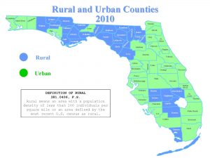
Dr. Liang Mao just received a UF Informatics Institute Seed Fund 2016 grant for his new project “Developing temporally comparable high resolution rurality maps for social and health sciences”.
The project will run from September 2016 to August 2017. Dr. Mao will investigate the concept of ‘rurality’ has been widely used by policy makers and governments at all levels to address social, economic, environmental, educational and health issues, such as health disparities, social isolation, and aging problems. Although many efforts have been devoted to distinguishing rural from urban areas (e.g., by the US census and USDA), current definitions of ‘rural’ remain spatially coarse and temporally incomparable. In other words, these rural definitions are oriented to large statistical units, such as the county, ZIP code area, and census tract, which were never originally designed to distinguish rural from urban geographies and simply assume uniform rural characteristics within large units. As a result, the effects of rurality on health/social outcomes can only be explored at the aggregate level, and the ecological fallacy can cloud the true relationships at the individual level. Meanwhile, conventional rurality measures at different time periods are not comparable due to inconsistency of definitions and classification criteria. Given that many health and social data are collected over time, current rural definitions are not suitable for longitudinal studies, and again hinder the identification of true relationships. We believe these are possible reasons that similar rural-health studies draw controversial conclusions in the medical literature. These limitations call for a rurality measure at a fine-grained spatial scale and temporally comparable, which would empower our society to more precisely and accurately appraise rural needs.