ASH, HASSAN, SOUTHWORTH – A Quantitative Framework for Analyzing Spatial Dynamics of Flood Events: A Case Study of Super Cyclone Amphan
Mohammad Mehedy Hassan, Kevin Ash, Joynal Abedin, Bimal Kanti Paul, Jane Southworth
Article first published online: 21 OCT 2020 Remote Sensing
DOI: 10.3390/rs12203454
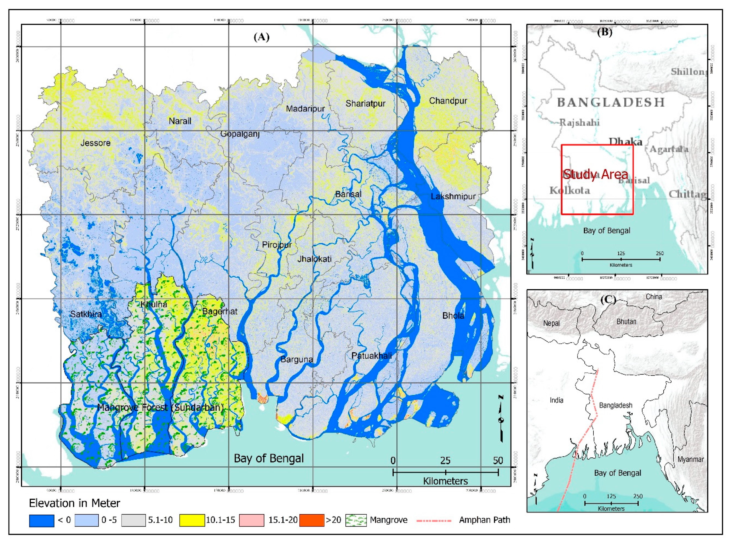
ABSTRACT: Identifying the flooding risk hotspot is crucial for aiding a rapid response and prioritizes mitigation efforts over large disaster impacted regions. While climate change is increasing the risk of floods in many vulnerable regions of the world, the commonly used crisis map is inefficient and cannot rapidly determine the spatial variation and intensity of flooding extension across the affected areas. In such cases, the Local Indicators of Spatial Association (LISA) statistic can detect heterogeneity or the flooding hotspot at a local spatial scale beyond routine mapping. This area, however, has not yet been studied in the context of the magnitude of the floods. The present study incorporates the LISA methodology including Moran’s I and Getis–Ord Gi* to identify the spatial and temporal heterogeneity of the occurrence of flooding from super cyclone Amphan across 16 coastal districts of Bangladesh. Using the Synthetic Aperture Radar (SAR) data from Sentinel-1 and a Support Vector Machine (SVM) classification, “water” and “land” were classified for the pre-event (16 May 2020) and post-events (22 May, 28 May, and 7 June 2020) of the area under study. A Modified Normalized Difference Water Index (MNDWI), and visual comparison were used to evaluate the flood maps. A compelling agreement was accomplished between the observed and predicted flood maps, with an overall precision of above 95% for all SAR classified images. As per this study, 2233 km2 (8%) of the region is estimated to have been inundated on 22 May. After this point, the intensity and aerial expansion of flood decreased to 1490 km2 by 28 May before it increased slightly to 1520 km2 (2.1% of the study area) on 7 June. The results from LISA indicated that the main flooding hotspots were located in the central part, particularly in the region off the north-east of the mangrove forest. A total of 238 Unions (smallest administrative units) were identified as high flooding hotspots (p < 0.05) on 22 May, but the number of flooding hotspots dropped to 166 in the second week (28 May) after Amphan subsided before it increased to a further 208 hotspots (p < 0.05) on 7 June due to incessant rainfall and riverbank failure in the south-west part of the study area. As such, an appropriate, timely, and cost-effective strategy would be to assess existing flooding management policies through the identified flooding hotspot regions. This identification would then allow for the creation of an improved policy to help curtail the destructive effects of flooding in the future.
Read the full publication at Remote Sensing