LIPPI, RYAN – Spatiotemporal Tools for Emerging and Endemic Disease Hotspots in Small Areas: An Analysis of Dengue and Chikungunya in Barbados, 2013–2016
Catherine A. Lippi, Anna M. Stewart-Ibarra, Moory Romero, Avery Q. J. Hinds, Rachel Lowe, Roché Mahon, Cedric J. Van Meerbeeck, Leslie Rollock, Marquita Gittens-St. Hilaire, Adrian R. Trotman, Dale Holligan, Shane Kirton, Mercy J. Borbor-Cordova, and S. J. Ryan
Article first published online: 27 APR 2020 The American Journal of Tropical Medicine and Hygiene
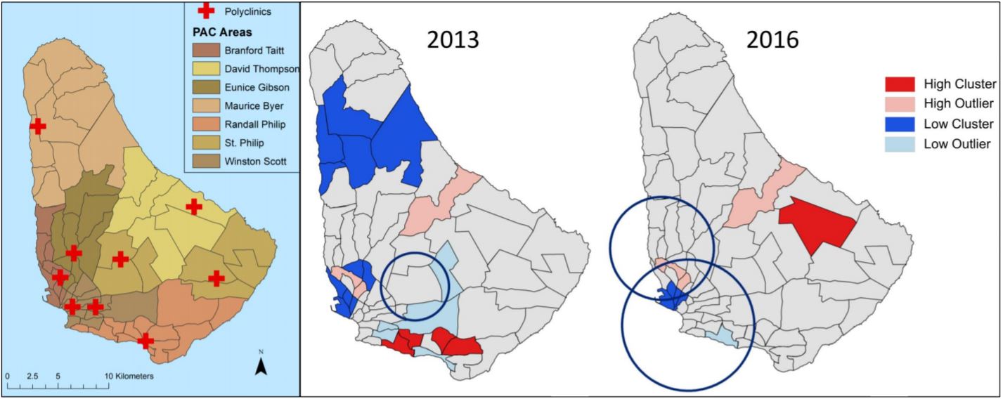
ABSTRACT: Dengue fever and other febrile mosquito-borne diseases place considerable health and economic burdens on small island nations in the Caribbean. Here, we used two methods of cluster detection to find potential hotspots of transmission of dengue and chikungunya in Barbados, and to assess the impact of input surveillance data and methodology on observed patterns of risk. Using Moran’s I and spatial scan statistics, we analyzed the geospatial and temporal distribution of disease cases and rates across Barbados for dengue fever in 2013–2016, and a chikungunya outbreak in 2014. During years with high numbers of dengue cases, hotspots for cases were found with Moran’s I in the south and central regions in 2013 and 2016, respectively. Using smoothed disease rates, clustering was detected in all years for dengue. Hotspots suggesting higher rates were not detected via spatial scan statistics, but coldspots suggesting lower than expected rates of disease activity were found in southwestern Barbados during high case years of dengue. No significant spatiotemporal structure was found in cases during the chikungunya outbreak. Spatial analysis of surveillance data is useful in identifying outbreak hotspots, potentially complementing existing early warning systems. We caution that these methods should be used in a manner appropriate to available data and reflecting explicit public health goals—managing for overall case numbers or targeting anomalous rates for further investigation.
Read the full publication at The American Journal of Tropical Medicine and Hygiene.