
Drone Mapping for Coastal Seagrass Monitoring and Citizen Science
Speaker: Dr. Bo Yang
Citizen Science GIS, University of Central Florida
Thursday, October 10, 2019
2:50-3:50 PM (Period 8)
Turlington Hall Room 3018
University of Florida
All are welcome to attend.
High quality multi-spectral observations with fine spatial resolution and frequent temporal coverage are indispensable in seagrass monitoring and analyses. An unmanned aerial vehicle (UAV), equipped with a multispectral sensor, affords an opportunity to improve upon satellite imagery for coastal management because of the very high spatial resolution, multispectral capability, and opportunity to collect real-time observations.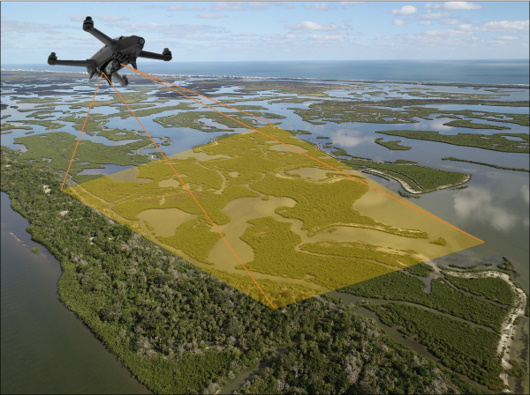
This talk will present results of our NSF seagrass drone mapping project. We performed multispectral UAV mapping fieldworks along the west coast of US. The UAV multi-spectral mapping method provided advanced information of the physical, an improved land feature delineation, and a significantly better mapping product than satellite imagery with coarser resolution (figure below). We also incorporated drone training and community outreach into the project with citizen science.