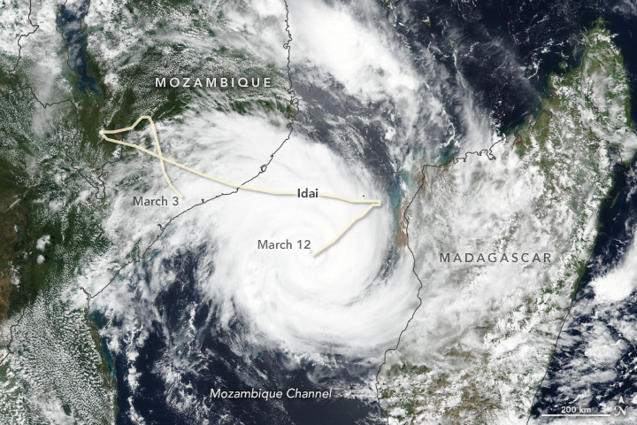
The March12th NASA Earth Observatory Image of the Day was a Terra-MODIS image of Tropical Cyclone Idai, preparing to make landfall on Mozamique.
For help interpreting the image, NASA asked UF Geography Professor Dr. Corene Matyas to explain what was in the image:
“Several cyclones in the past have started over Mozambique and then moved over water and intensified into more organized systems, although this type of situation is not common,” said Corene Matyas, a researcher at University of Florida who has studied cyclones in this area. It is relatively common, however, to see cyclone tracks in the Mozambique Channel that meander and loop, due to weak steering currents.
Cyclones that form in the channel tend to be weaker than those that form over the Southwest Indian Ocean, north and east of Madagascar. But Matyas points out that regardless of where a cyclone forms, some have reached their highest intensity within a day before landfall. Tropical Cyclone Eline in February 2000, for example, passed over Madagascar and the Mozambique Channel, and then quickly intensified just before landfall in Mozambique.
“Keys to intensification are warm ocean waters to sufficient depth, the absence of strong winds in the upper troposphere, and being contained inside of a moist air mass,” Matyas said. “These conditions are all present right now.”
If you want to become an expert in weather and climate, check out our Certificate in Meteorology and Climatology.